
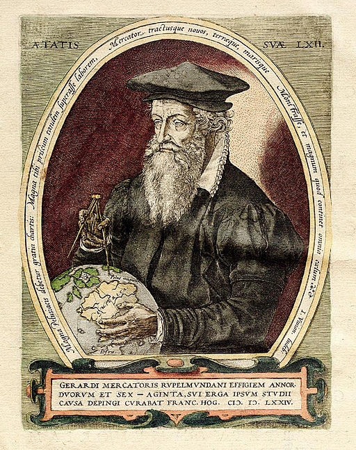
Gerardus Mercator (1512 – 1594) never travelled very far. Apparently, he was a bit of an armchair traveller, which is most relevant today as, due to the lockdown, none of us can go very far. However, in 1569 he designed the map of the world that we all still recognise today. His principle known as the Mercator projection is still used in Sat Nav and GPS.
Dorset History Centre holds hundreds of maps going back to the late 16th century. These come in all shapes and sizes and can range from maps of the whole county, maps of small areas of local estates to detailed street maps of towns. Many maps were produced for legal or official reasons by statue or military purposes, such as the early Ordnance Survey maps. Some of these historic maps in the archives are still used today for legal purposes relating to rights of way and boundaries. Our visitors also access them to research their home, town, village, family and the history of the Dorset landscape.
The most regularly used maps at DHC include the tithe maps, estate maps and historical Ordnance Survey maps.
Tithe Maps
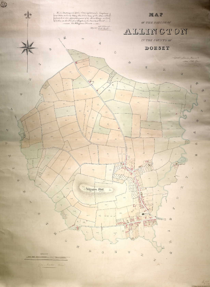
There are nearly five hundred tithe maps covering most of the parishes in Dorset. These were nearly all produced in the 1830s and 40s. Tithes were a tax of one tenth of all agricultural produce given in kind to support the Church. In 1836, payment in kind was changed to payment in money by the Tithe Commutation Act. The tithe maps were commissioned to survey each parish and establish who owned and who occupied (was a tenant) the land and so ‘apportion’ the payment of the taxes accordingly. This collection contains maps for each parish showing numbered plots of land along with an apportionment which links to the numbered plots. The apportionment lists who owned the land, the tenant, the measurement, what the land was used for and the name of the plot of land.
Dorset tithe maps can also be found on Ancestry which is free online to members of Dorset libraries during the current lockdown. More information is available on LibrariesWest.
Estate Maps
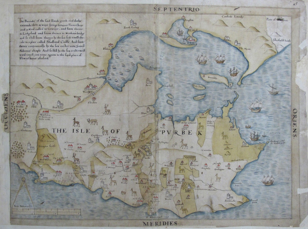
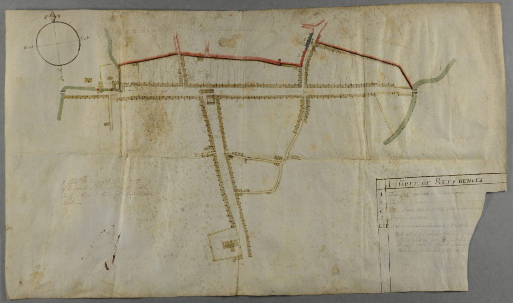
In our Bankes Estate collection is a series of the oldest and most iconic maps at DHC – Ralph Treswell’s maps and surveys of the manors including Corfe Castle, Studland and Langton Wallis (reference: D-BKL/E/A/3/1).These were drawn in the 1570s for Sir Christopher Hatton, the then owner of the Purbeck estates which later formed part of the area owned by the Bankes family of Kingston Lacy. They are colourful and eye-catching maps illustrated with overlarge rabbits, deer and fish shown at the same scale as the numerous ships sailing the nearby coast!
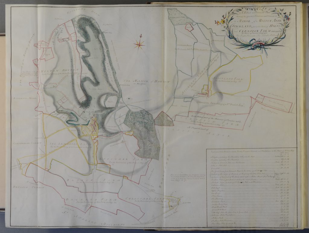
Our collections include many other estate maps surveyed and drawn by both local and national cartographers of some renown employed by Dorset landowners to create beautifully illustrated maps. A fine example of these is the Milton Abbey Estate Survey and Map (1769 – 1770) by William Woodward, (reference: D-919/5).
Estate maps are often linked to surveys of the estate listing the tenants of each plot of land, its measurement and sometimes the rent paid. This enables you to follow an area of land through time using the estate maps, tithe maps and the early Ordnance Survey maps.
Street Maps
Printed maps of counties and street maps of towns were also produced from an early date. In the early 17th century John Speed produced a series of county maps which included inserts of principal towns, such as a map of Dorset with an insert depicting Dorchester, 1611. Other local examples of street maps include a beautifully simple 18th century parchment map of Bridport (reference: DC-BTB/R/2). Anyone living in Bridport today would still recognise the layout of the streets and buildings.
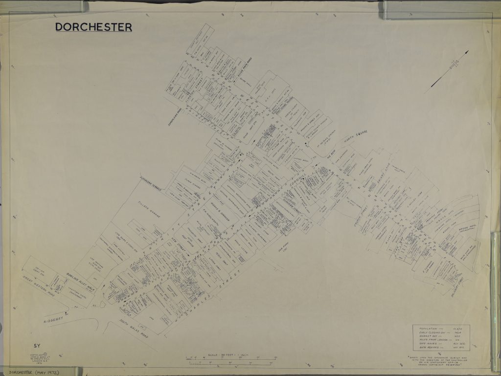
In a similar vein but much more up to date are the Goad maps. These modern printed maps show the use of property in the middle of towns, and show the shops and businesses on the high street. DHC has a series of these from the 1970s to 2019 for various Dorset towns. This is a map of Dorchester from 1972, though quite recent, most Dorchester residents today would not recognise the same businesses (reference: M/163/1).
Lockdown Maps
Maybe all you budding armchair travellers out there could use some of these maps as inspiration to create a series of lockdown maps of your own surroundings? Use drawings, stories, photographs, collages of your houses, flats, streets, pets etc. and bags of your imagination of course. For some more inspiration, check out Common Ground’s project on parish maps: www.commonground.org.uk/parish-maps. In fact, we recently received a collection of Common Ground’s material to hold at DHC!