
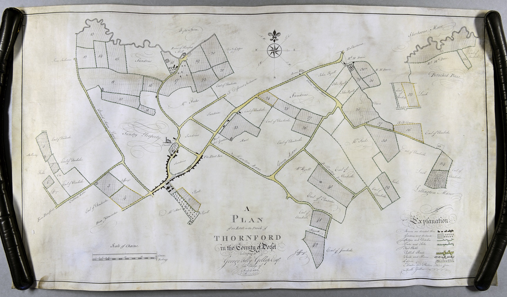
Thanks to the Dorset Archives Trust Document Purchase Fund the Dorset History Centre recently purchased a beautiful 1802 manuscript map of an estate in Thornford. Thornford is in the north west corner of Dorset near Sherborne. It was prepared for George Tilly Gollop and surveyed by John Davioge of Ansford (probably near Castle Cary) in 1802.
George Tilly Gollop was a Dorset landowner who actually lived in Netherbury but, in common with most 18th and 19th century landowners, held lands in many parts of the county including areas around Netherbury and Sherborne.
This is typical of an estate map in that it shows numbered plots of land owned by George Tilly Gollop. There would have been a written survey that listed the numbered plots of land, probably showing the names of the tenant, the area of the plot, what it was used for (e.g. arable, meadow, house, garden etc), and possibly what rent was paid by the tenant. The map also indicates who owns the other land in the area with the Earl of Pembroke owning much of the parish. Dorset History Centre holds other uncatalogued records of the Gollop family in Thornford so it is possible that the survey for this map is amongst them.
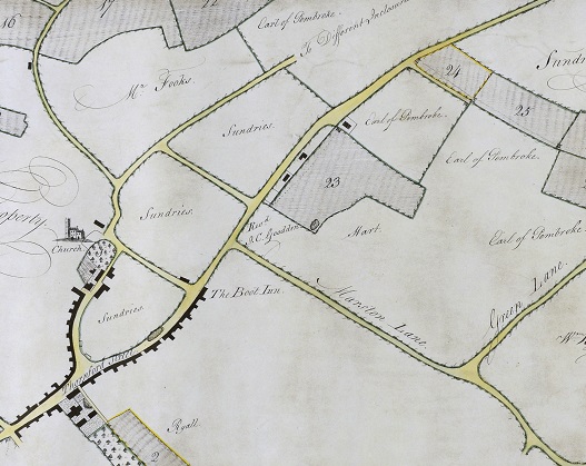
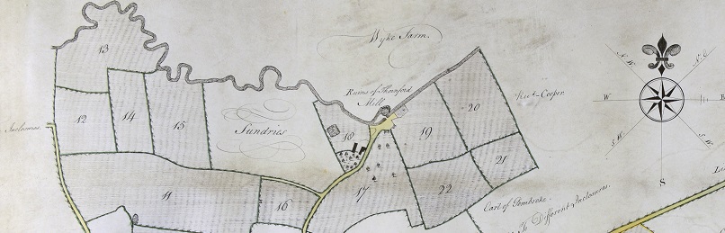
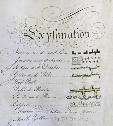
The map is a good example of how it is possible to see the development of road layouts, bridleways and footpaths in an area, as well as explaining local features and landmarks. John Davioge has included a lovely little drawing of the church and has noted the position of the Boot Inn in the village. The Boot Inn seems to have survived until the 1880s when the Kings Arms became the village pub, this still exists today, but presumably Boot Lane is a reminder of the earlier village pub. The ruins of Thornford Mill can be seen on the River Yeo, which perhaps clarifies why the course of the river is different at this point. The Explanation or Key clearly shows features such as hedges and ditches, stiles and gates and footpaths and ‘publick roads’. This can be very useful and maps such as these have been used to investigate the status of modern rights of way.
The map is a wonderful snapshot of Thornford village at the beginning of the 19th century and useful for researchers in providing additional information for the period before the Tithe map and census.