
People have been travelling the roads of Britain for hundreds of years. How, you might wonder, did they know where they were going? Without Sat Nav and Google Maps, it would be a miracle if most of us could get anywhere these days! If you have been questioning this too, then you may be interested to know about the publication of the first road atlas of England and Wales…
The atlas was the creation of John Ogilby, who was born in Scotland in 1600, the son of a wealthy Scottish gentleman. The family moved to London when Ogilby was a child, but his father soon got into debt and was imprisoned. Ogilby was able to pay off the debts after investing in a lottery and went on to lead a very interesting – and very mysterious – life as a dancing master and theatre owner, bookseller, printer, and translator of works of literature. At some point, he became a master cartographer – one of the most influential in the country’s history.
In 1675, by which time he had been appointed ‘His Majesty’s Cosmographer and Geographic Printer’. Ogilby published Britannia Depicta, the first road atlas of England and Wales. It was a novel concept that brought about a change in the way maps were used, giving rise to several ‘road books’ intended for use by travellers. But Ogilby’s publication looked quite different from what we might think of as a road atlas today. Rather than showing all the roads in a particular area, Ogilby wanted travellers to be able to follow a single line between two specified places. His maps took the traveller on a journey along a thin line all the way from departure to destination, with towns, hills, rivers, and other landmarks marked along the way.
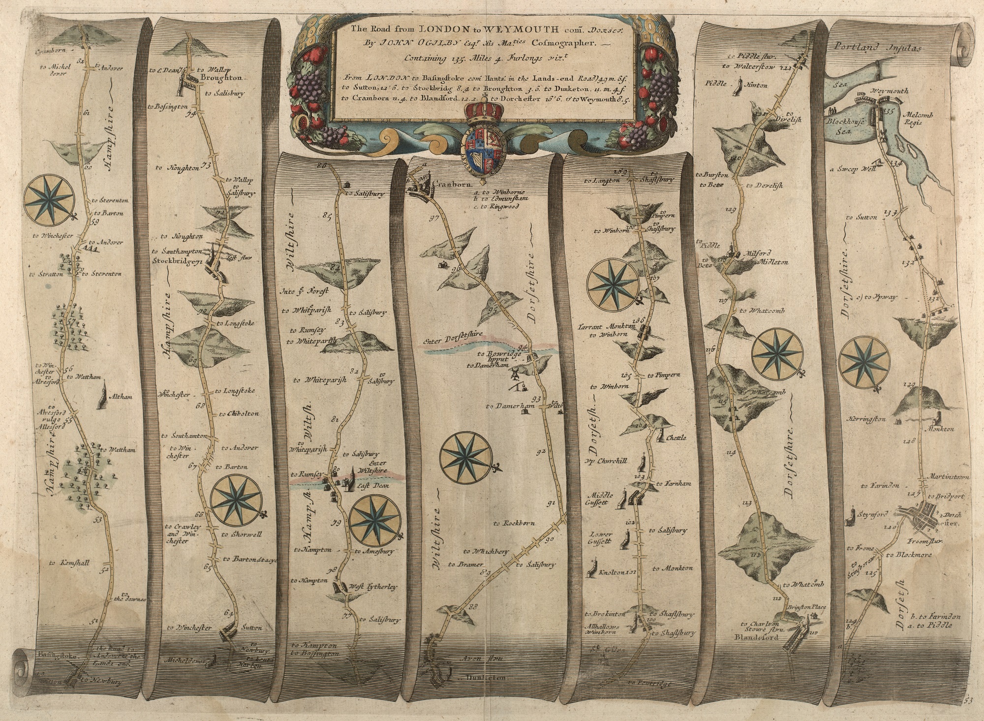
At Dorset History Centre, we hold several prints of Ogilby’s maps. This one shows the final part of his route from London to Weymouth. The hills are drawn to show the direction at which they were inclined and their relative steepness, and the destinations of all the side roads has been noted. Plans of towns were sometimes given on Ogilby’s maps, and on this one you’ll be able to see the familiar, almost grid-like layout of Dorchester.
Seventy-three roads were surveyed and accurately measured in preparation for Ogilby’s publication. Measurements were taken using a surveyor’s wheel. This was essentially a large wheel with a handle, linked to a comptometer – a type of early mechanical calculator. A surveyor would push the wheel along the road in front of him and the distance he travelled would be displayed on a dial. You might remember doing something similar around the playing field at school!
In a break from tradition, Ogilby used the Statute Mile (5280 feet/1760 yards), introduced by an Act of Parliament in 1593 (but not widely used until much later), to measure all roads featured in his atlas. In doing so he dispensed with local or ‘customary’ miles, which varied in length from 2035 to 2500 yards. The distances from each map’s specified departure point were marked along the route, with the scale being a standard – and, at the time, innovative – one inch to a mile. Compass wheels showed the direction in which a traveller should be walking at various points, and in Britannia a written description gave additional advice for the map’s use.
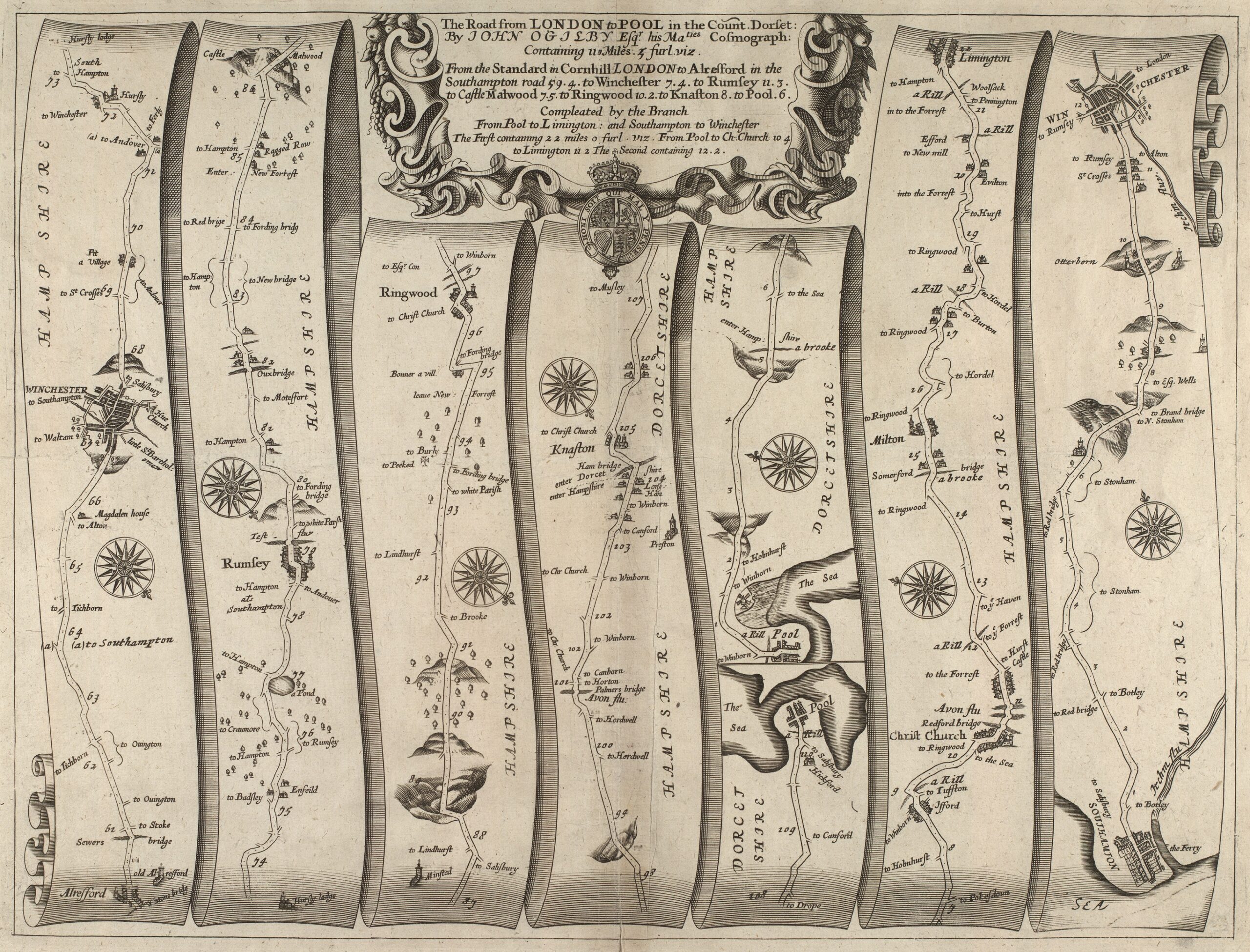
Also amongst our collections, this map shows the route from London to Poole, and then on to Southampton. Those familiar with the area will no doubt you will be able to spot well-known local landmarks, such as Poole Harbour, Redford Bridge in Christchurch and the River Avon.
From the moment of its publication, Ogilby’s atlas was in great demand. Further editions were published, and the maps went on to be printed as individual sheets like those held at the History Centre. They were even reproduced (many years later) in pocket-sized books by John Senex and Thomas Gardiner, which much easier to transport than the original atlas! Ogilby himself died in 1676 and was buried at St. Brides Church in London.
I still use proper maps in conjunction with a Sat Nav and Google Maps. The latter aren’t infallible but merely useful tools which have to be treated with caution. As a result I often hear the words “route recalculation” from my Sat Nav!