
There are a number of resources online to be able to view modern and historic maps of Dorset. In this blog we will explain a little about how to access some of these maps and offer some tips on how to make the most out of your searches.
Dorset Explorer
DorsetExplorer is Dorset Council’s online mapping application that gives everyone access to a huge range of layers and tools. There are numerous layers you can use to overlay onto a modern map such as, historic OS Basemaps from the late 1800s, Aerial Photography, Administrative Boundaries and much more. All in a simple to use yet hugely powerful application.
Base Map?
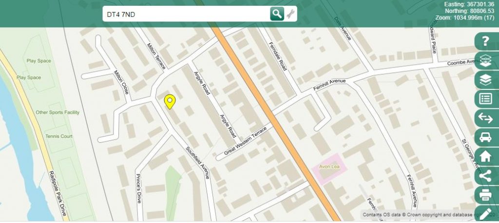
Start by searching for the place you are interested in by either town, postcode, road etc and a base map will open:
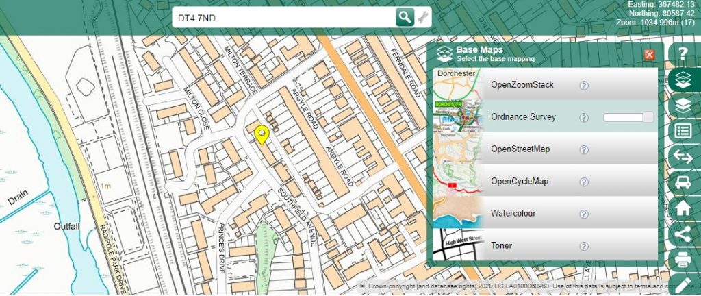
You can change this base map by clicking on second icon down on the menu on the right hand side, in this instance going to an Ordnance Survey map:
Layers?
Having established which base map you want can start to add layers by clicking on the third icon down on menu bar on right hand side:
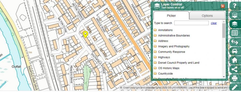
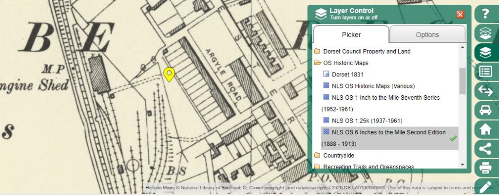
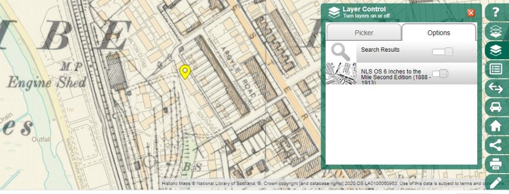
Click on one of the files to choose what you want to overlay on the map you are viewing at the time. The options are varied but include historic maps, as shown below, administrative boundaries, aerial photographs etc:
By going into the options side of the menu you can fade the old map onto the newer map to help comparison of the two:
National Library of Scotland Ordnance Survey Maps
The National Library of Scotland have an online database of maps dating from 1841 to 1960. Although the majority of historic maps relate to Scotland, they do have Ordnance Survey maps covering England, Wales and Great Britain from 1841. It’s worth noting that not everywhere has a first edition map but most areas are covered by the second edition dating from 1902.
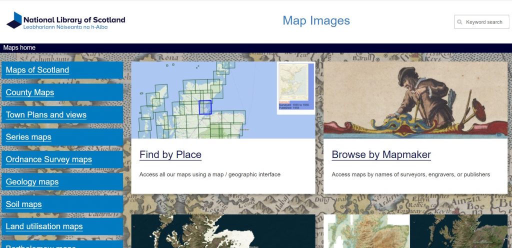
The site has numerous options, but the quickest way to find something is to select ‘Find by Place’ from the homepage:
This will open a map of England, Scotland and Wales, with a menu on the left:
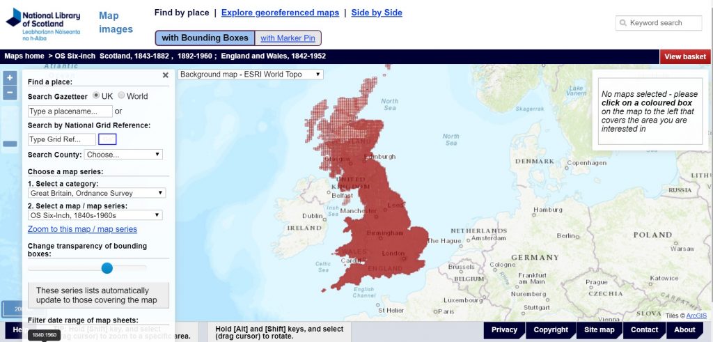
You can then either double-click on the area you are after to zoom in, or use slider on the left side of the screen. Alternatively, you can ‘type a placename’ in the menu on the left to find where you want to search. You can also use the menu to choose which map series you wish to view (including options such as OS Six-inch, OS 25-inch; or OS One-inch):
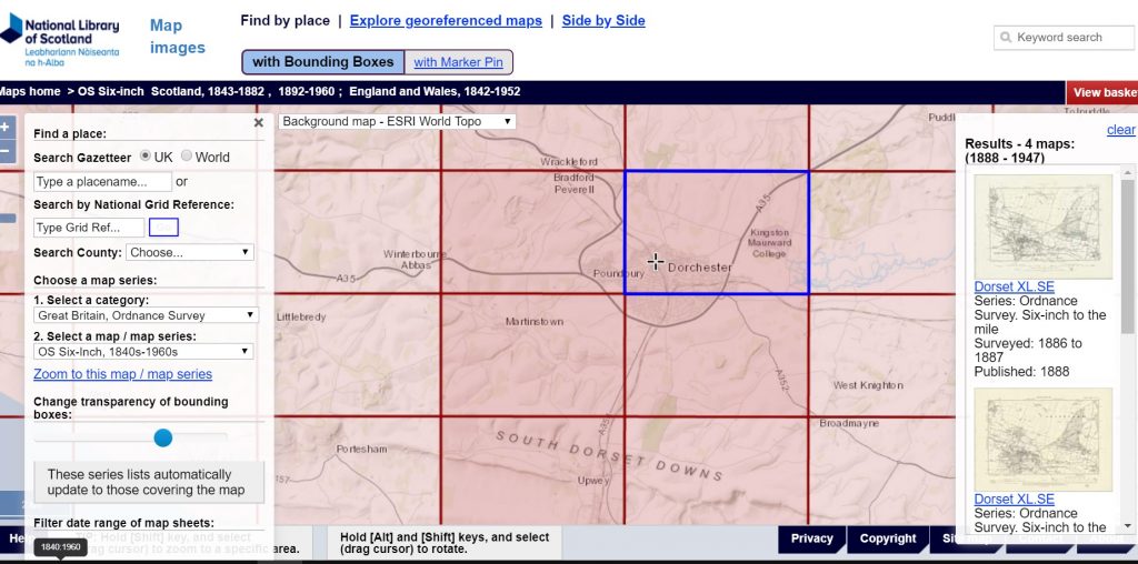
By clicking on a square on the main central map it will highlight just that area and show, on the right-hand side of the screen, what historic maps are available are to view for the area depending on the type of map you initially selected. You can then click on the historic map you wish to view:
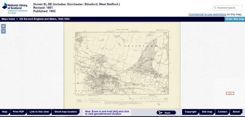
At the top of the screen, there is information about which map you’ve selected, and what date it is from. You can then zoom in and out on any area you wish to look at in the same manner as before. You can then order copies of the map from the NLS using the option in the top right corner should you wish.
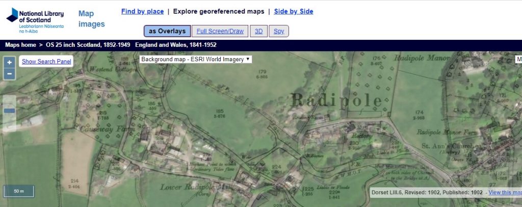
The National Library of Scotland are also geo-referencing a growing proportion of their maps. Geo-referencing aligns an historic map image with its real-world location. This allows you to compare historic maps to other dates of mapping, including modern satellite imagery and maps. For example, the satellite image of Radipole overlaid by the 1902 Ordnance Survey map of Radipole as shown below:
There are detailed instructions on what is contained on the site and how to use it. There are also ‘Help’ pop ups throughout your search to give assistance if needed. The best way to learn is to just use it and play with the different applications available!
Ancestry
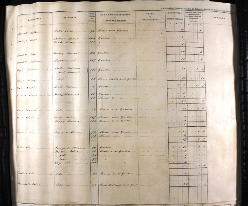
DHC has partnered with the family history website Ancestry to give online access to our records. One collection you can find on Ancestry are our tithe maps. These large-scale maps were produced circa 1840, to identify the amount of tithe – or tax – payable on land across each parish. Each map is accompanied by a survey (known as an apportionment) which lists information for each plot. The apportionment includes:
- the names of the landowner and the tenant;
- the name of the premise or piece of land;
- the size and use of the land;
- and the amount of tithe payable.
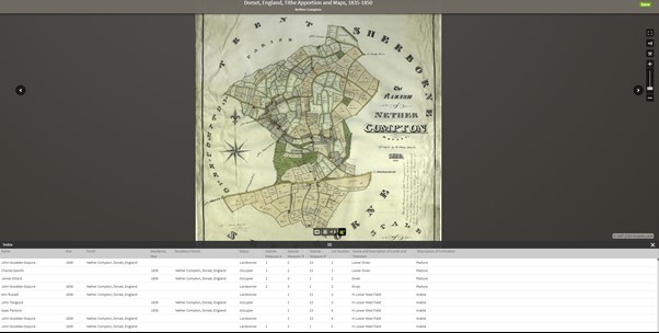
Ancestry will show you the map (which you can zoom into or out of), as well as a digital copy of the apportionment underneath.
Tithe maps can support your research in a variety of ways. If you are researching the history of a house, you can use the information in the apportionment to identify landowners and tenants. Ancestry also shares national records such as censuses, so you are able to search for the tenants and track the land’s occupants. Tithe maps are also useful when researching you family history, to show where family members lived and how they moved around the county. Of course, these aren’t the only uses for tithe maps – they can support so many more types of independent research!
During the current coronavirus pandemic, Ancestry is available for free to members of LibrariesWest. If you live, work or study in Bath & North East Somerset, BCP (Bournemouth, Christchurch & Poole), Bristol, Dorset, North Somerset, Somerset or South Gloucestershire you can join the library service online. Alternatively, you can access Ancestry from your home computer by subscription.
—
We hope this has been a helpful exploration of our three most used online mapping resources. Of course, we still hold hundreds of other maps in our collections, and we look forward to welcoming you back to DHC in the future to explore some of them!
I’m looking at the tithe maps on Ancestry for my ancestors in Thornford. Ancestry provides a copy of the tithe map plus details of the plot number, its size and use. But it does not give the amount of the tithe – in your text on this site you state that the tithe amount is given. Grateful for your advice on where this information is held on Ancestry. Thank you.
Hi Paula, thank-you for your comment. It seems that the information used on Ancestry has been taken from transcriptions of the apportionment documents rather than the originals. Unfortunately these transcriptions only have the names of people and the size of the land/s in question recorded on them, hence why the tithe amount is missing. I’m afraid that the only way to see that information would be to visit us to consult the original apportionment document.