
During the pandemic, we published a blog about online maps, noting three different sources of information and how you might use each of them to help you with your research. This blog has proven to be one of our most-read blogs ever, and hopefully it has acted as a useful guide to many people.
Whilst two of the three sources of information remain more-or-less the same as when we published the original blog in May 2020, we wanted to update information relating to Dorset Explorer, a system used by Dorset Council to provide a very wide range of information through an interactive map.
Dorset Explorer is an extremely powerful tool which can provide people with all sorts of information about life in Dorset, including, but not limited to, who your local MP is and where are their constituency boundaries; where the local footpaths are in the county; or historical aerial photographs. In this blog we wanted to update you with information about Dorset Explorer, and some of the key things you might want to use to help inform your historical research!
Getting Started
It is important to note that there are now multiple aspects to Dorset Explorer, namely:
- Countryside
- Historic Dorset
- Planning public
- Collisions public
- Family locality teams
- Strategic Flood Risk Assessment
For the purposes of this blog, we are going to focus on the ‘Historic Dorset’ page. To get to this page firstly open up Dorset Explorer in your web browser. In the top left corner of the page there is a button which stage “Change version”:
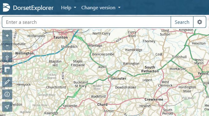
Click on this button and select “Historic Dorset” from the options. This will then refresh the page, and you’re ready to explore the historic records.
To view the different sorts of records available on Dorset Explorer, you can use the icons on the far right of the page:

For the purposes of our use, we shall be selecting options from the ‘layers’ button, which is the second icon down in that menu, and when clicked will bring out a menu which looks like this:
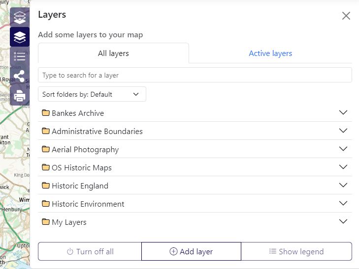
Using the different layers
There are multiple different options to pick from in this menu, so we’re going to point out three of them, and you are welcome to explore the others!
—
Bankes Archive
Between 2015 and 2018 Dorset History Centre undertook the ‘Unlocking the Bankes archive‘ project. During the life of this project, staff and volunteers contributed well over 100 blogs to the project website. As we reach 2024, this project website is no longer functional in the way it originally was, and we have made the decision to close the website permanently. On the site there was an interactive map, with overlays and pins which showed some of the stories relating to the collection.
With the closure of the above-mentioned site, these maps and pins have been transferred over to Dorset Explorer, and selecting this option from the layers tab will give you different options, any of which you can ‘add’ to your original map:
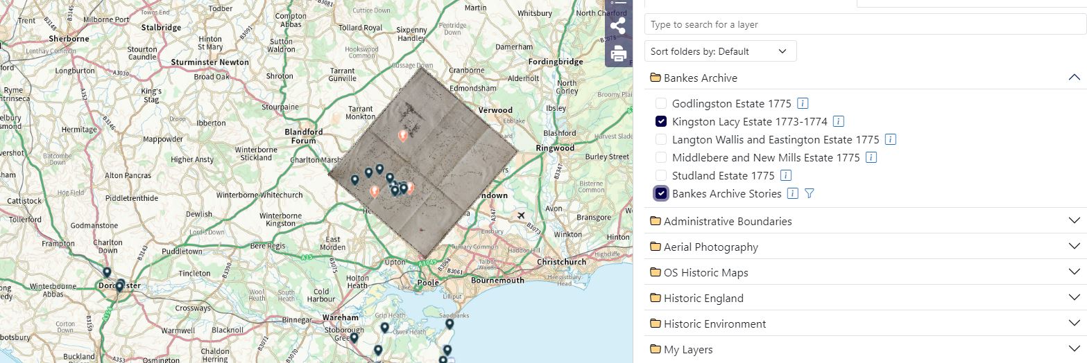
In the above example, we have added the “Kingston Lacy Estate 1773-1774 map” as well as the “Bankes archive stories” options, which has added an overlap map and various pins to the site. The overlay map look slightly strange, but it should be remembered that when it was made in the 1770s, north didn’t always have to point to the top of the page! The overlay map has been geo-rectified so that places on the old map are more-or-less in the correct place in modern terms.
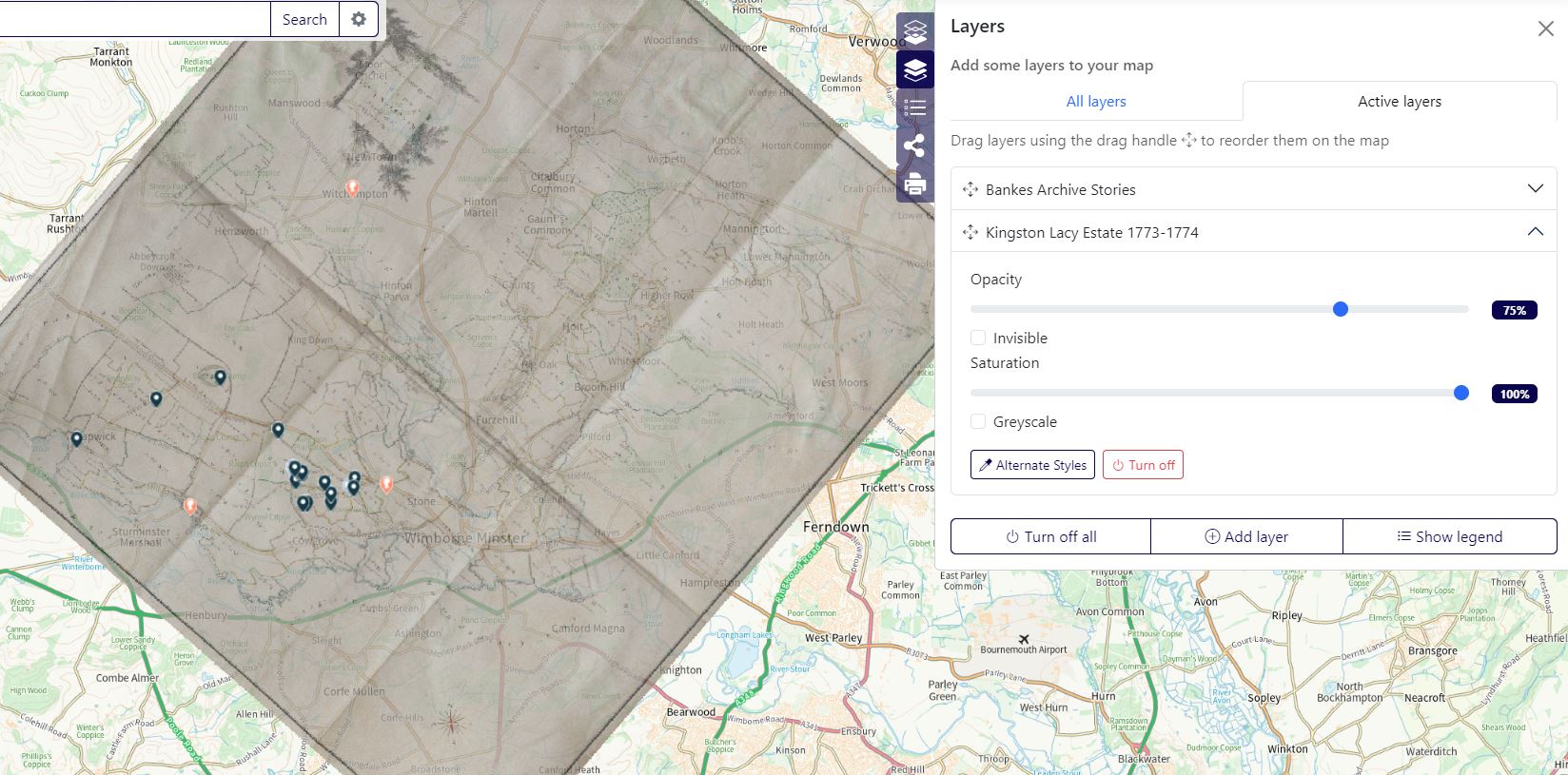
You can then use the ‘active layers’ option on the ‘layers’ menu on the right to alter the opacity or saturation of the overlay map, should you want to see the original map underneath:
—
OS Historic Maps
The next element of the site we wished to touch on is the OS Historic Maps. Much like the overlay maps mentioned above, the OS historic maps give you the option to add OS maps to the standard map to explore what the county looked like at different times. These overlays are more thorough than the ones from the Bankes project however, as they will cover the entire county and beyond:
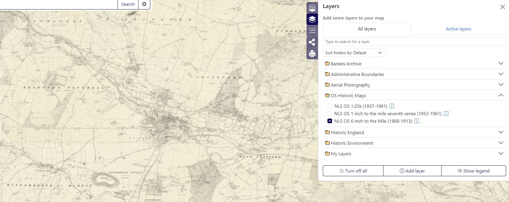
In the above example, we have chosen the NLS OS 6 Inch to the Mile (1888-1913) overlay. In a similar manner to the Bankes Archive elements, you can make this map more opaque using the ‘active layers’ tab, so you can compare the older maps with the modern map for any area.
—
Aerial Photography
The final element we wanted to touch on in this post is that of aerial photography. There are a range of aerial photographs of the county available to be viewed through the site, ranging from 1947 through to 2021. By checking one of the options, you should see a series of symbols spread over the map, or an overlay that looks like Google Earth. The symbols (if you’ve chosen the ‘historical aerial imagery’ options) represent individual photographs taken from planes that flew a specific flight path…
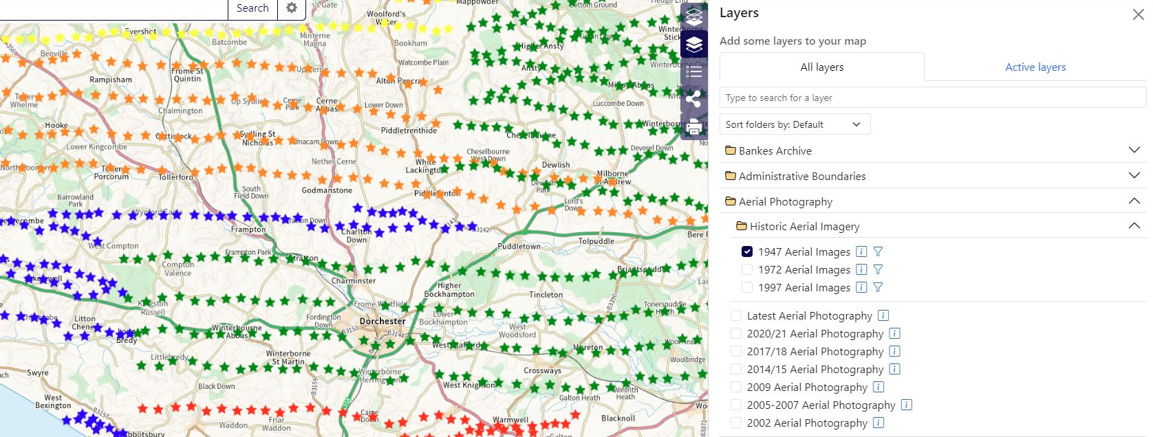
In this example, we have chosen the 1947 aerial images option from the list, and the stars show us where there were photographs taken. Clicking on one of the stars will give you further information, and you can click on ‘view full size’ to see the image in a new window:
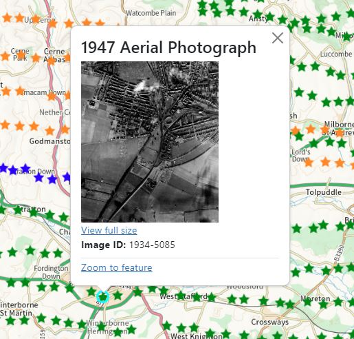
The aerial photographs offer a snapshot of an area for three distinct years: 1947, 1972 and 1997. Obviously things can change an awful lot in the intervening period, but these aerial images do offer a glimpse of how towns and the countryside changed in the latter part of the 20th Century.
—
There are plenty of things to explore on Dorset Explorer, the above examples are only a small fraction of the information and detail which is available on the site. At Dorset History Centre we always encourage users to have a look at this site to see what they might be able to find!
Dorset Explorer is a great source of information but I, as a member of the public, cannot get in . Attempting to get in, I meet this message “The requested URL was rejected. Please consult with your administrator.
Your support ID is: 866149278632188522”
I’d be delighted if you could advise me how I could access this service!
Hi Gerald – thank-you for your message, and we’re sorry to read about your issues getting into Dorset Explorer. Unfortunately we do not administer DE so all we can suggest is that you complete this online form with information about your issue: https://dorset-self.achieveservice.com/service/Dorset_Explorer_feedback. Hopefully the GIS team responsible for DE will be able to assist you from there.