

Earlier in the year, two of our volunteers Dave and Adrian, completed work on listing a large pile of previously unknown architectural plans and drawings from Weymouth. In this blog, Dave explains a little more about what was in the pile…
—
Over recent months, along with another volunteer Adrian, I have been listing a collection of previously undocumented documents, plans, maps and artist impressions which have been languishing on the dusty upper shelves of the Archives for many years. These range in size from long narrow lengths of paper(5/6metres), through standard paper sizes down to scraps on a variety of papers and materials. They were acquired from Weymouth and Portland Planning department. These were mostly rolled bundles which had to be listed and boxed. 207 boxes and 1172 listed items now make up this collection. Some boxes only have one or two items while others have many, these often being part of a larger plan produced by outside consultants or planners.
Maps, plans and artist impressions follow the growth of Weymouth and Portland. The earliest document is a copy of the 1571 charter joining Weymouth to Melcombe Regis. However the first original document is from 1815 showing proposals for changes to Weymouth Harbour. The youngest dated document is from 1997.
The development of housing estates such as Downclose and Littlemoor are well documented. The Downclose Estate (where I grew up), built in the late 40’s and early 50’s is extensively covered with diagrams showing the layout of housing, road plans, drainage and landscaping. The Littlemoor estate, built much later, includes working drawings with hand-written notes on how the work was completed. These drawings also include the finer details about doors, windows, staircases and all the items needed when building a modern house.
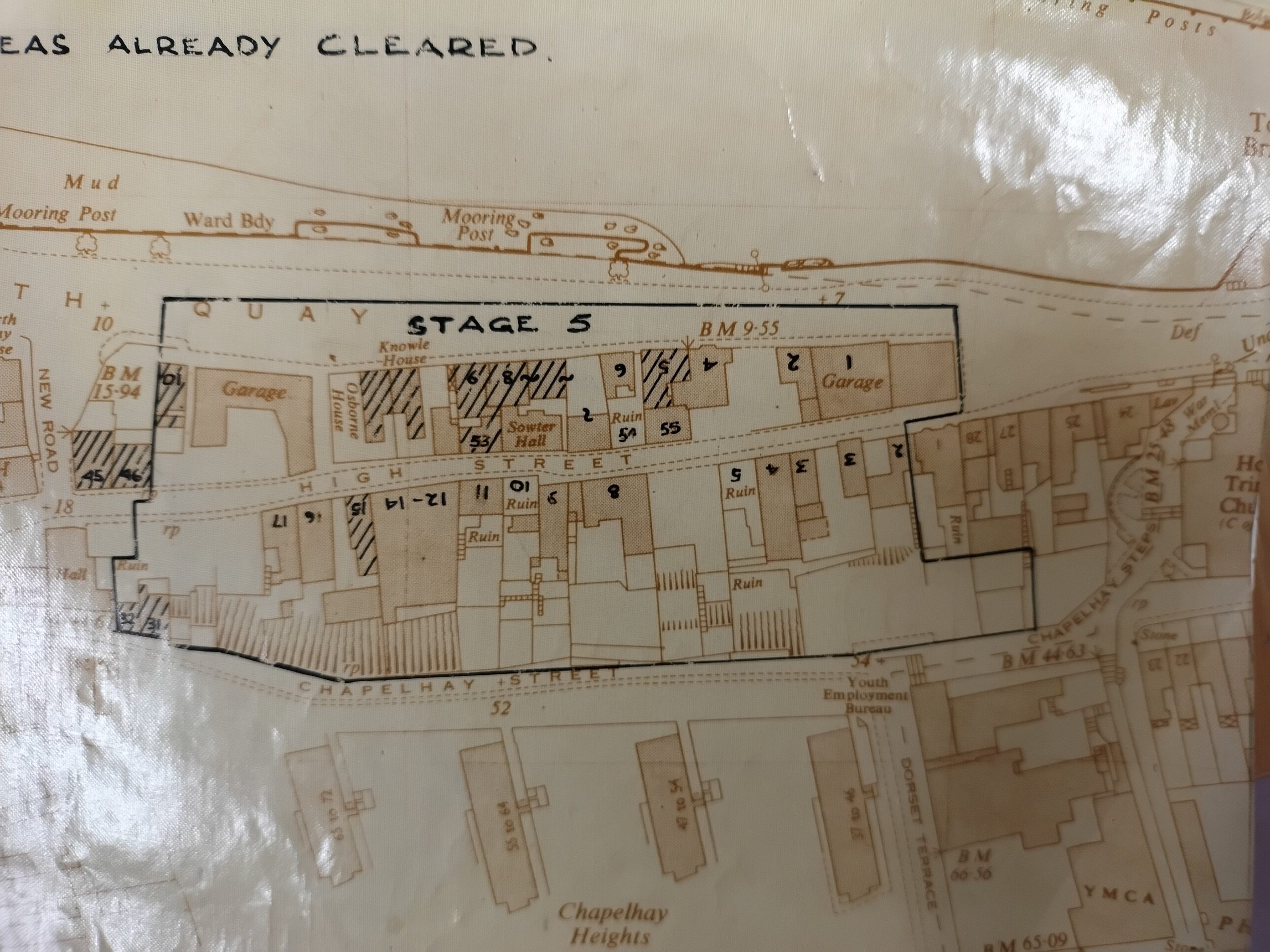
Chapelhay featured in the last rolls that I sorted. Documents in this collection show the project lasting from 1942 to 1959. The first map that sprung out (and I do mean sprung out because it was so tightly rolled), was of part of the old Weymouth High Street and North Quay. This featured as part of stage 5 of the Chapelhay project and shows buildings already cleared. Interestingly, 6 North Quay, where my great grandparents and family lived, is still standing. I am unsure of the date they moved out but they were there at the date of the 1939 registration. Like many of the items in this collection this map is not dated.
The oldest document(1959) in this part of the Chapelhay project refers to changing steps to a ramp next to Holy Trinity Church. The steps were changed but the handrail was left, at a level that would have been okay for steps not a ramp! (It is still the same today)
Some guess work, my local knowledge or the name of the borough engineer helped identify or guess many of the missing dates. Many of the items do have a number which would have been helpful if the list of the numbers was available! The type of paper changes over time – the earliest documents are often on heavy linen backed paper whilst the newer ones are on thinner paper or acetate.
There are many plans and diagrams relating to sewers and drains. The Town Bridge, Pier bandstand, the ‘new’ Pavilion theatre, Embankment bridge and works in the harbour, including dredging information are all documented. Many maps, plans and artist impressions are extensively devoted to some ‘failed’ projects. A Hoverport and the Nothe Hotel(1967/8), a holiday camp (Butlins) on Lodmoor(1960) are featured in fine detail. Many hours must have been spent in this pre-digital age working on artists impressions. (more of this in a future blog). Lodmoor featured in documents from 1938 onwards. Restrictions on building, water levels, pumping stations, car parks, public conveniences, proposed developments such as the holiday camp, housing and even a heliport can all be found in the documents.
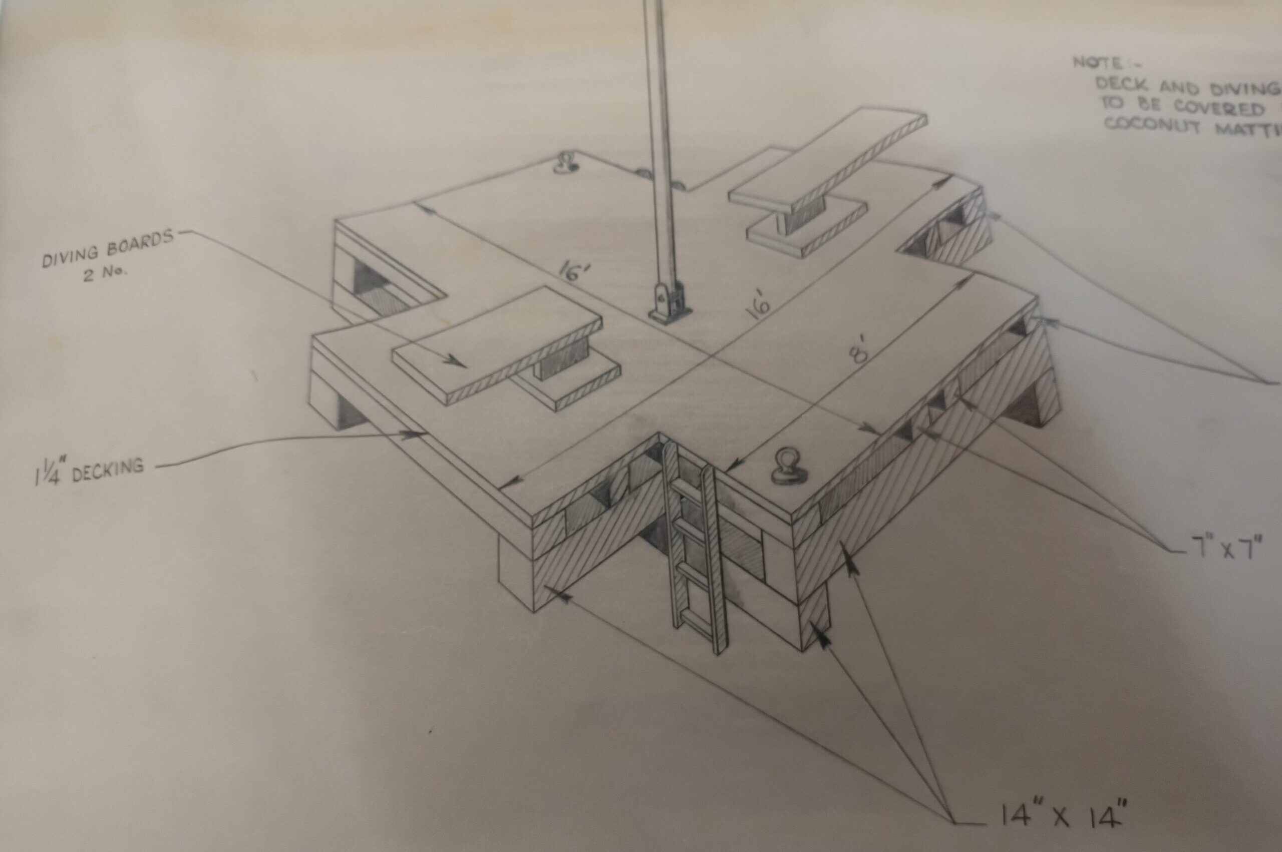
The demise of rafts at Greenhill has featured in the news this year and coming across the original plans for the originals, brought back happy memories of these rafts that were a feature of my childhood.
There are ‘secret’ government documents relating to the seas around Weymouth and Portland (they say – must not be copied). Planning documents relating to individual houses, whether it is new builds, window replacement, changes to bathrooms are intermingled with major road plans or railway works.
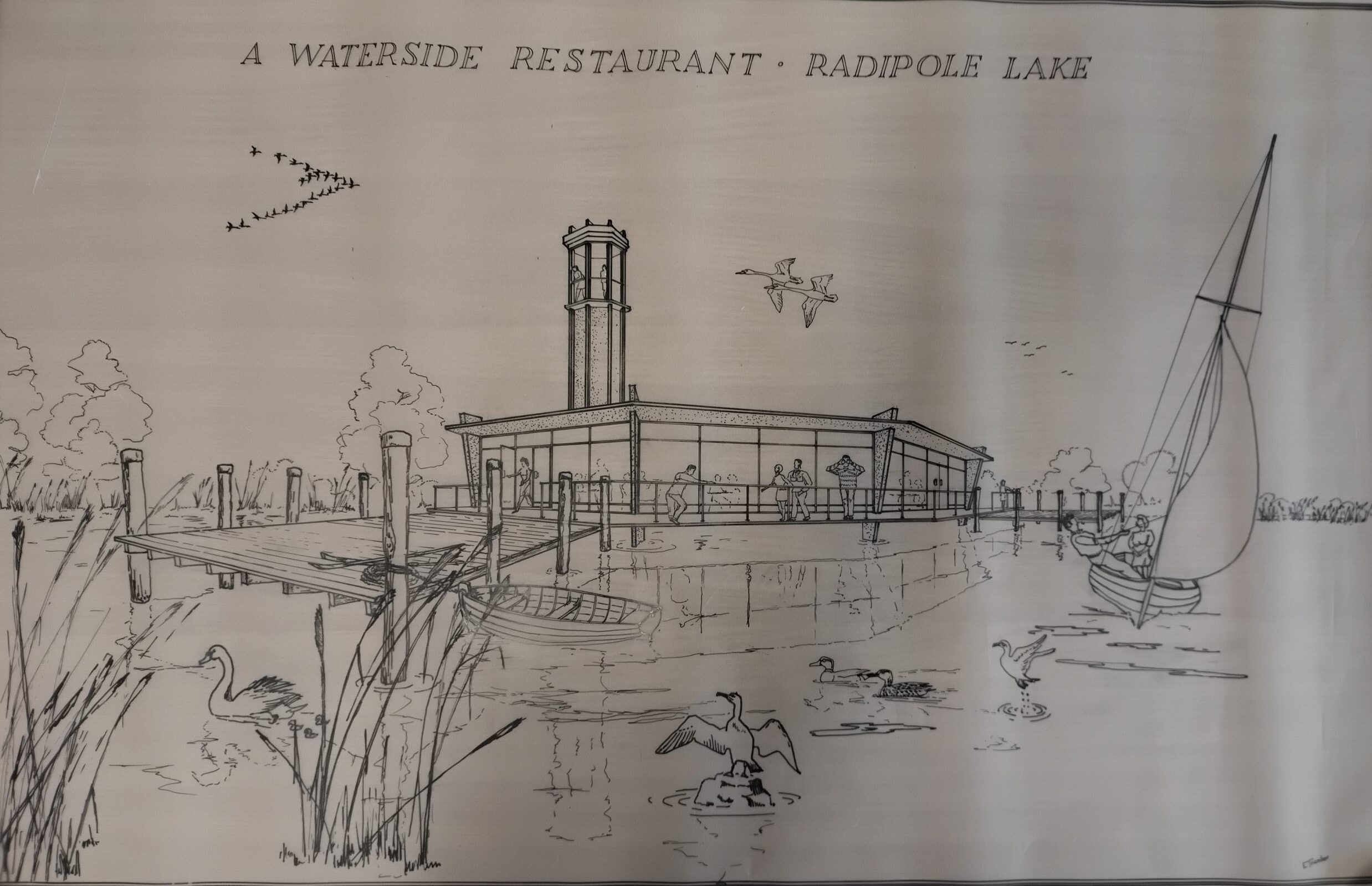
There are some very good artist impressions, and I include the one of a Waterside Restaurant on Radipole lake which was in a bundle of Chapelhay documents! No date, no artist name, but this seems to be an artist’s impression of what is now the Ghurkha restaurant? I cannot ever remember seeing sailing dinghy’s on the lake!
Many of the items must have been hastily bundled together, rolled and passed on to the History Centre and it has been my pleasure to open them up and get a glimpse of Weymouth where I grew up.
—
This is a guest blog written for Dorset History Centre by volunteer Dave Wraight. We are extremely grateful to both Dave and Adrian for their hard-work in listing and detailing these plans and records. They have been given the reference DC-WYM/UA/Acc 12560.
The Waterside Restaurant is definitely not what turned into the Gurkha. That was built as the Noah’s Ark Aquarium in 1966. Rather it is likely to relate to one of the various Radipole Lake development plans in the late 1940s and early 1950s. These plans included extensive leisure facilities on reclaimed areas of the lake but were shelved in 1955 in favour of developing Lodmoor.
Thanks for this. This set of plans and drawings has no mention of the development of leisure facilities on Radipole lake but does have extensive plans for Lodmoor. The 2nd blog in this series will cover these plans.